

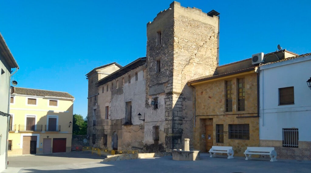
AUG-ARQUITECTOS, SLP has submitted the initial version of the General Structural Plan (PGE) and the Detailed Planning Plan (POP) to the Benissuera Town Council (Valencia) for approval at the plenary session. This submission is a crucial step in advancing the processing of this planning instrument. The municipality of Benissuera is located in the La Vall de Albaida region, approximately 82 km from the provincial capital. It covers an area of only 1.90 km² and has a population of around 170. It is, therefore, a small town where the work carried out has been tailored to the size of the area to be planned, providing a significant level of detail.
The new plan is very restrained in its design and avoids unnecessary expansion of the existing land, prioritizing the preservation of key identifying features, as the land itself does not present any inappropriate or discordant topographical elements. The town has a distinctive character and a reasonable level of environmental quality, and it is hoped that this will continue.
In this context, the main objectives of the new General Urban Development Plan (PGE) are the following:
- From an environmental and landscape perspective, the attribution to the eastern part of the rural land of the appropriate and necessary level of protection to safeguard its values, as well as the classification of the western part of the municipality, dedicated to dryland farming, as a common agricultural rural zone.
- The consolidation of Benissuera’s residential character as a space with its own identity, despite its small size, characterized by tranquility, accessibility, proximity to public amenities, and the predominance of low-density housing types.
- The incorporation into the urban area of the development completed on Don Francisco Ferri Puerto Street, as it is land in a basic urbanized state, with the completed infrastructure and the designated public land allocated. This area, adjacent to the residential urban land, follows local urban planning and building guidelines and is perfectly integrated into the urban fabric.
- The consolidation of the predominant residential building types, which give the town a special character, especially due to their low height.
- The delimitation of a single developable land sector, for residential use, as a continuation of the urban fabric to the northwest.
- The maximum simplification of the management of land with insufficient urbanization, taking into account that in this land only the service road area needs to be developed and, consequently, it is not necessary to establish the regime for integrated developments; it is sufficient to develop it under the regime for isolated developments.
- Growth in new housing below the threshold of 100 units, for the purposes of Article 33.3 of the TRLOTUP (Revised Text of the Land Planning and Urban Development Law).
- The identification of local heritage and its protection in the corresponding Catalogue of Protected Heritage, so as to guarantee its preservation, foster appreciation and respect for it by residents, and interpret the existence of these elements as a foundation for consolidating a pleasant town with higher urban quality.
- The appropriate delimitation, in accordance with the TRLOTUP (Regional Land Planning and Urban Development Law), of the provisions regarding green areas and school facilities. This provision for land transfers has been formulated after a detailed study of the municipal land assets and taking into account the limited room for maneuver offered by the PGE (General Urban Development Plan), which proposes a very narrow growth margin and does not foresee any increases in building density on urban land.
- The incorporation of urban planning regulations adapted to all current sectoral regulations, supra-municipal protection measures, and current, proven, and rigorous criteria for regulating these types of areas. These regulations must continue to contribute to the improvement and requalification actions of urban spaces that the city council has been promoting in recent years. Along with these regulations, the PGE also provides highly transparent and precise digital mapping.
Regarding the detailed planning, the main objectives of the new POP (Plan of Planning and Development), assuming there is only a small newly developed area located as an extension of the existing residential urban land, are summarized as follows:
- Development of a detailed plan using high-quality cartography, addressing the shortcomings of the current planning. This includes providing precise maps based on a new cartographic foundation and employing current best practices for translating the content of a Public Planning Ordinance (POP), including its provision in digital format for accuracy verification.
- Respect for the existing planning regulations and minimal changes to the ordinances, as they are based on efficient and well-established models, requiring only essential innovations.
- Maximum simplification of management, assigning small-scale urban consolidation projects to the Isolated Actions regime through the transfer and development of service roads in three specific areas.
- Incorporation of simple ordinances adapted to all current sectoral regulations and criteria, as well as to the requests of the city council, within the scope of its authority.