

The City Council of Cofrentes now has the draft of the Structural General Plan (PGE) and the Detailed Ordination Plan (POP), along with their corresponding Initial Strategic Documents (DIE), prepared by AUG-ARQUITECTOS SLP, a leading firm in the drafting of these types of planning instruments in the Valencian Community.
Cofrentes is undertaking a review of its planning, which dates back to 2003, conditioned by the announcement of the likely closure of the Cofrentes Nuclear Power Plant in 2030. This plant, which has been operating since 1985, is the economic engine not only of this municipality but also of the surrounding region, directly employing around 1,000 people, including Iberdrola’s own staff and those of the permanent contractors who work within the power complex. Indirect and induced employment is estimated at another 1,000 jobs through maintenance, logistics, security, and technical service providers throughout the province. In addition, the plant undergoes technical shutdowns every 18 to 24 months for fuel renewal and technological optimization, with one-off investments exceeding €45 million per period. These critical phases temporarily attract more than 1,200 specialized external technicians, completely saturating the hotel, restaurant, and retail capacity of the entire region for several weeks.
Faced with the announcement of the supposed closure, the Cofrentes Town Council has been exploring a plan for progressive economic diversification for years to mitigate the serious effects that the plant’s closure will have on the local economy. In this context, the new general plan becomes a key element, which must contribute to the established objectives, especially regarding the promotion of the tourism sector, with a strong emphasis on thermal spas, and the attraction of industrial activity and the creation of available land.
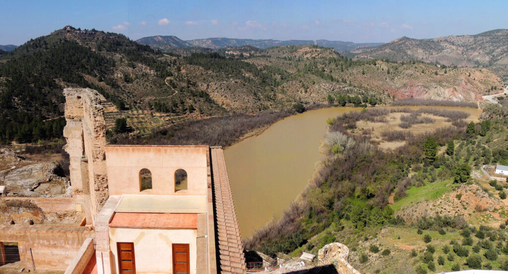
Thus, the documentation presented by AUG-ARQUITECTOS, SLP offers complete and precise information, with abundant graphic analysis, of a very rich and attractive territory due to the confluence of the Cabriel and Júcar rivers. This area boasts a range of alternative electricity generation options unlike any other municipality in Spain: a nuclear power plant, a hydroelectric plant, and wind and solar farms. Among the landscape’s unique features is Cerro Agras, also known as the “Cofrentes Volcano,” a volcanic outcrop located on the left bank of the Cabriel River. This volcano is the only recent volcanic outcrop in the Valencian Community and is notable because its underground magma chamber continues to emit gases, feeding the Hervideros Spa. The historic Cofrentes Castle (whose surroundings were protected by a plan also developed by the same company) sits atop one of its ancient volcanic vents.
AUG-ARQUITECTOS, SLP has been working in the town for over a decade and is responsible for the latest modifications to the 2003 General Plan of Urban Ordination (PGOU), the Special Protection Plan for Cofrentes Castle, etc. With the launch of the new PGE-POP, the city council has entrusted this company with its medium- and long-term territorial and urban project, pursuing the following objectives:
At a structural level, the following objectives are pursued:
- To align, as far as possible, the major decisions of the plan with the criteria outlined in Articles 3, 7, 12, and 13 of the TRLOTUP (Revised Text of the Land Planning and Urban Development Law), prioritizing public space redevelopment projects from a gender perspective, promoting sustainable urban mobility, and protecting the distinctive features of local urban planning and architecture. Equally important, the plan also aims to ensure that the proposals of the General Urban Development Plan (PGE) are consistent with the promotion of the tourism and thermal spa sectors and with the attraction of industrial activity and available land, as outlined in the progressive economic diversification plan designed by the city council.
- To identify, within the planned territory, the key elements that have their own specific legislation (hydrological network, network of livestock trails, roads, major infrastructure networks, etc.) and to apply the corresponding protection measures to them. This identification includes incorporating the actual route of major road infrastructure, such as the N-330 highway, into the PGE’s base maps.
- Assessment of all existing risks across the territory and detailed location of major electricity generation and transmission infrastructure, with a significant presence in the municipality of Cofrentes.
- Assigning the appropriate level of protection to a portion of rural land, necessary to safeguard its values, while maintaining protection across a significant percentage of the municipality.
- Adjusting the growth projections for protected land to the thresholds established in the ETCV (Valencian Territorial Strategy), even though these are no longer binding but rather indicative, and to the municipality’s realistic expectations, from a containment perspective.
- The provision for sufficient new productive land to facilitate the relocation of productive activities outside the town center as soon as possible, given that the town center is predominantly residential. This will allow for a clear separation, in the medium and long term, between areas designated for housing and public facilities and areas designated for industry.
- The provision for mechanisms to obtain public land for public facilities in a way that preserves financial stability and the security of public finances. This involves including the proposed public land (pending acquisition) within areas subject to planning. This entails a detailed study and the quantification of the public land for public facilities within the structural network planned in the General State Budget (PGE) and pending acquisition, which in the case of Cofrentes is limited to the expansion of the cemetery.
- The provision of the necessary urban planning mechanisms from a perspective of maximum simplification, so that in the town center of Cofrentes, the delimitation of the land subject to planning and its classification respond to the criteria established in the TRLOTUP (Revised Text of the Land Planning and Urban Development Law) and to the limited local experience in urban planning management.
- The provision of green areas, land designated for school use, and facilities of all kinds in sufficient quantity, designating significant reserves of land for public facilities without a specific use (multi-purpose public facilities), thus providing the population with a substantial strategic reserve of land for facilities, already secured by the town council.
- The delimitation of a Traditional Historic Center, which is designated as a Locally Relevant Asset due to the preservation of its urban fabric and the presence within it of numerous elements of architectural interest. The protected elements in this area are joined by those located in other parts of the region.
And at a detailed level, the objectives of the POP are:
- Development of the detailed planning based on high-quality cartography, relying on the Consolidated Text of the current planning regulations. Therefore, to provide highly accurate plans, based on sound cartographic principles, and to employ current criteria for translating the content of a POP, including its submission in digital format (shp), for accuracy verification purposes.
- Updating all existing public facilities land within urban and developable areas and assigning the corresponding uses.
- Improving the quality of the planning of the village of Basta.
- Abandoning the planning of new development areas, as it is understood that the necessary circumstances to justify such planning do not currently exist (and in order to avoid the tax consequences that this would entail for landowners).
- Respect for existing regulations to the greatest extent possible, with the introduction of necessary changes to ordinances and graphic planning (maps) to enable the achievement of the proposed urban quality improvement objectives for urban areas.
- Simplification of management to the greatest extent possible.
- Incorporation of simple ordinances adapted to all current sector regulations and criteria, as well as to the requests of the city council, within the scope of its powers.
- Expansion of the elements protected as listed assets in the Cultural Section (detailed organization of the Catalogue of Protections).
With the submission of the documentation to the relevant environmental bodies, the city council will begin a process that, over the coming years, will define the ideal territorial model for this unique town in the Valencian Community.